Newcastle floods two different ways, and they leave different problems behind. Neither is what most people picture when they hear the word flood.
Talk it throughRising Damp Newcastle arranges damp assessments across Newcastle and the Hunter.
Flash flooding is the common one. Intense rain over the local catchment produces runoff that exceeds the drainage network, and the water rises fast. In Newcastle that means the creeks — Throsby, Styx, Cottage, Dark and Ironbark — and the suburbs built around them.
Hunter River flooding is the slower one. Sustained heavy rain across the wider Hunter catchment lifts the river until it spills into the low-lying floodplain — Hexham, Beresfield and Sandgate.
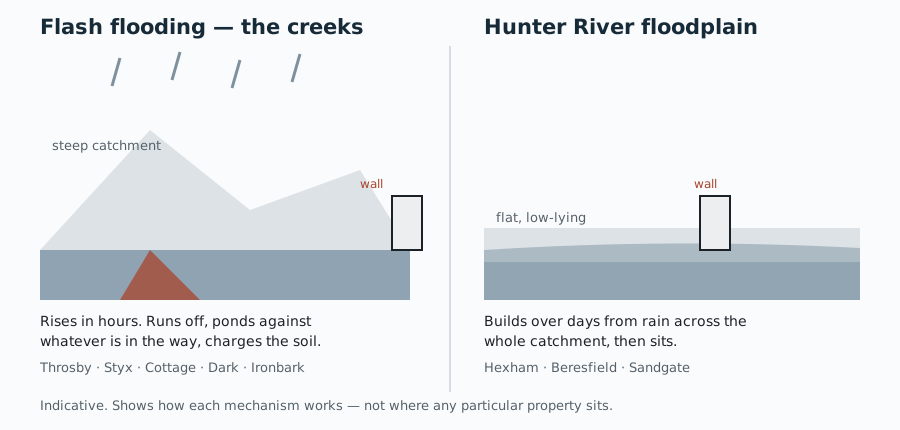
The damage you can see dries in weeks. The ground does not. Water that arrives fast charges the soil around and under footings, and in a closed subfloor that ground stays wet for a very long time — feeding moisture into every course of masonry it touches by the same capillary action as ordinary rising damp, with a much larger reservoir behind it.
Floodwater also carries dissolved salts into the wall. That is why flood-legacy damp is saltier and more destructive than the everyday kind, and why it surfaces months after everyone has moved on.
Flood classification is property-specific and carries planning and insurance consequences. It is maintained by the council and the State Emergency Service, and a redrawn version on a trade website is worse than useless — it looks authoritative and quietly goes out of date.
Check the real thing: City of Newcastle — flooding, which carries the city-wide Floodplain Risk Management Study and the flood studies behind it; and the NSW Flood Data Portal, the SES-hosted repository of the actual studies and hazard datasets.
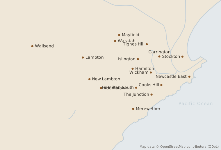
The 2023 Throsby, Styx and Cottage Creek Flood Study is the current picture for the eastern half of the city — from the harbour north, the coast east, taking in the CBD, Merewether, Kotara and Mayfield West. It replaced a considerably older and coarser model, so anything citing pre-2023 flood behaviour for those suburbs is out of date.
An even horizontal line, roughly 600mm to 1.2m above the floor, on a ground-floor wall. It marks where the water stops climbing and starts evaporating. Condensation does not produce a level line like this.
Salts left behind as the water evaporates. Brushing it off works until the next wet spell.
Almost always a non-breathable coating over a wall that needs to dry outward. The coating is not failing — it is working, in the wrong place.
Salt crystallisation forcing the surface apart. Worst on the coastal strip and usually well advanced before anyone calls it damp.
Not damp. That pattern points at ground movement. Across much of Newcastle that means mine subsidence. That may be compensable, and it needs a different call entirely.
Flash flooding out of the creek catchments charges the ground for weeks. Flood-legacy damp is saltier and more destructive than the everyday kind, and it surfaces months later.
The order matters. Say the real problem is a cracked footing. Injecting a damp course into that wall is money spent on the wrong thing. That is why the assessment comes first and the quote comes after.
Readings up the wall, then outside: levels, the rear lane, paving, downpipes, and whatever render or paint is already stopping the wall breathing.
Stepped cracking points at ground movement, not moisture. In a Mine Subsidence District that is a different call and possibly a compensable one.
Rising damp, lateral damp through a cut-in wall, a leak, condensation, or what a creek flood left behind. On a Newcastle wall all five leave a mark near the floor and only one needs a damp course.
Ground above the damp course is the fix, not a second damp course below it. Injecting under a bridge changes nothing and you will have paid for it.
Injected into one mortar course, sized to the wall thickness. A shared wall is drilled from one side only, so the spacing tightens and the day gets longer.
Salt left in the render pulls moisture out of the air on its own. A wall with a perfect new course and its old plaster still reads damp, and the owner assumes the course failed.
Roughly a month per ten millimetres of wall thickness. Double brick means most of a year before it is ready to paint, and painting early undoes the work.
We arrange assessments across Newcastle and the lower Hunter, including:
 Rising Damp Newcastle